As there has been very low rainfall during July and August, only 116 mm in the estuary and 145 mm around Lake Cootharabah, the river water has been more stabilised and turbidity has reduced even further to give clear water along much of the shoreline. Salinity and pH have also remained steady throughout, although one quite acidic pH value of 3.3 was recorded in the fresh water of the upper Noosa River. The small creeks now have very low, if any, flow, so those measured parameters tend to be less reliable.
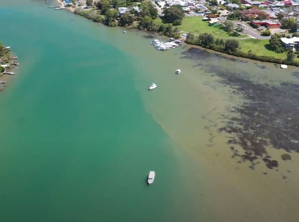
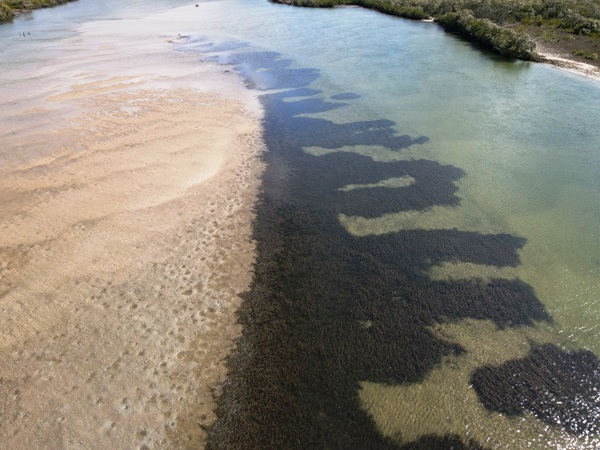
NICA are now commencing an aerial survey of the river and adjoining banks using a Mavic Air 2 drone which we have acquired recently. This technology has amazing potential to record the appearance of the water, to study and quantify the extent of all its features such as seagrass beds, mangroves, rock reefs, algal growths, discoloured water discharges, and of course erosion of the banks. It is planned to obtain a baseline record of the river banks during this relatively dry period with clear water everywhere, which can be used at subsequent times to identify and analyse any changes. Individual features such as the important seagrass beds can be subjected to close inspection and measurement as individual projects. Any members who have special skills or interests in drone technology are invited to participate in this project or to suggest any other applications for the drone.

Seagrass Tewantin

Seagrass Weyba Creek
We have continued collecting water samples for nutrient testing by Noosa Council. With reduced rainfall all nutrient residues have remained low, and within the same ranges as previous tests.
Thanks to the Waterwatch team members who have contributed to all the above work, and special thanks to Klaus Horner who has contributed his special skills in video and media technology by operating the drone and recording and editing the film footage resulting from the scans.
NICA are pleased to acknowledge receipt of a grant under the 2021 Community Connect Program administered by our State Parliamentary Representative Ms. Sandy Bolton, and we thank Ms. Bolton very sincerely for enabling us to obtain the Mavic Air drone to be used for our surveys.
By Bruce McConkey


